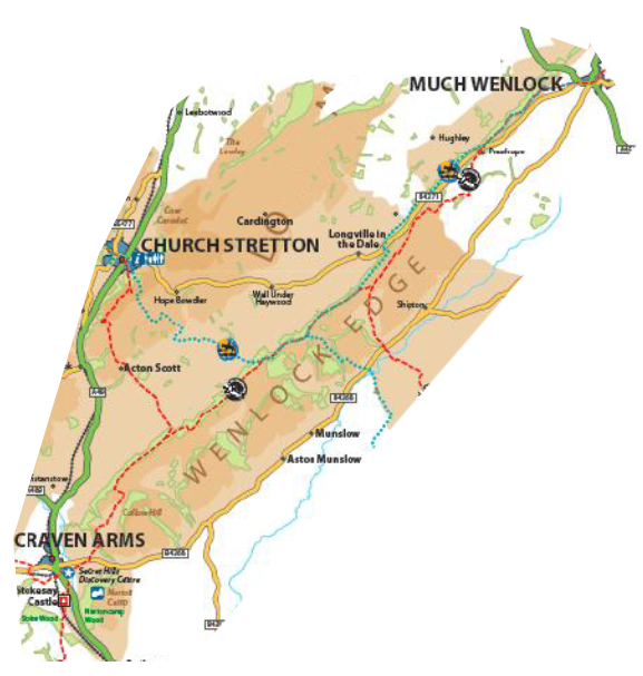
Wenlock Edge & Dales
More lowland in character than much of the Shropshire Hills, the Apedale and Corvedale either side of Wenlock Edge are relatively quiet and secluded.
This area has more intensive and arable farming.
The National Trust own and manage substantial parts of Wenlock Edge. This famous wooded limestone escarpment is a major landmark, running over 20 miles from near Much Wenlock to Craven Arms and separates Ape Dale from the Corve Dale. There are significant former quarry sites on the back of Wenlock Edge, along with areas of species-rich calcareous grassland.
The Corve Dale lies mostly outside the National Landscape but is of conservation value through its many heritage features, the River Corve itself, veteran trees including black poplar, and in views between Wenlock Edge and the Clee Hills.
Farming is more diverse in this area due to lower-lying and better quality land, and so has more options for the future than the uplands. More intensive methods and large agricultural buildings therefore have particular potential to cause harm to the landscape quality of the area.
Ash dieback will be a particular issue in this part of the Shropshire Hills where ash is more common on the lime-rich soils, especially around Wenlock Edge.
Some former quarry sites on Wenlock Edge have been used for industrial activities, which may have limited the areas potential of this part of Wenlock Edge to develop into a really significant visitor destination and contributor to the sustainable tourism economy. There remains a need to maximise opportunities for conservation and quiet enjoyment where possible.

